

Case study · Māori land project
Clear, Shared Tools for Big Decisions About the Whenua.
Te Waimana Kaaku Trust · Waimana, Eastern Bay of Plenty
- Client
- Te Waimana Kaaku Trust
- The land
- Matahi Forest estate: seven land blocks covering 2,124 hectares
- What we did
- Highest and best land-use assessment and digital decision tools (Ake Projects)
- Funding
- Ministry for Primary Industries' Māori Agribusiness programme
Where They Started.
Matahi Forest estate, in Waimana, is made up of seven land blocks covering 2,124 hectares, about half of it in production forestry. With harvest decisions ahead, Te Waimana Kaaku Trust wanted a clear picture of what the land could do next, and a transparent way to weigh the options with its beneficiaries.
What We Did.
In 2019 the Trust engaged Ake Projects (then trading as Ake Innovation) for a highest and best land-use assessment, funded through MPI's Māori Agribusiness programme. We:
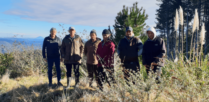
- Listened first. Steering group meetings, a tikanga-based site visit, and tribal hui and drop-in sessions, so beneficiaries set the criteria the options were judged on.
- Read the whenua. Land titles, land-use capability, soils, climate, waterways and biodiversity, plus historical aerial photos going back to 1949.
- Weighed ten options. From long-rotation timber and mauri enhancement to koura farming, horticulture, meat farming and guided hunting.
- Built two digital tools. A weighted decision-making matrix the Trust can re-weight as priorities change, and a digital dashboard comparing tribal demographics with regional and national census data.
- Mapped the funding. Pathways through the Provincial Growth Fund, the Sustainable Food and Fibre Futures fund, the Whenua Māori Fund and Māori agribusiness programmes.
What Changed.
The Trust received the assessment in September 2019: an evidence base for post-harvest decisions, and tools that make the options, and the reasoning behind each one, easy to share with the wider tribal community.
More from Māori Land Trusts & Iwi.
All case studies
Māori Land Trust · Projects
From Kiwi Recovery to Māori-Led Eco-Tourism.
Ōmataroa Rangitāiki No.2 Trust · Eastern Bay of Plenty
Read the storyPost-settlement entity · Accounting
Reporting the Board Can Use, and Idle Cash Put to Work.
Te Rūnanga o Ngāti Pūkenga ki Tauranga Trust · Tauranga
Read the storyWhenua with Potential? Let's Have a Kōrero.
We work alongside trustees on compliance, governance and the projects that move the whenua forward. No jargon, no obligation.